
Market Place Gallery

Market Place was converted to a pedestrian precinct in the late 1970s. 
Market Place was converted to a pedestrian precinct in the late 1970s. 
The War Memorial was moved to Market Place from its original site in Queens Square in 1977 
Market place when it was still open to through traffic. The “flying saucer” lampposts would suggest a date in the 1970s. 
Market Place with motor traffic, possibly from the 1960s. 
A view from the 1950s / 1960s with the two storey police station on the right. 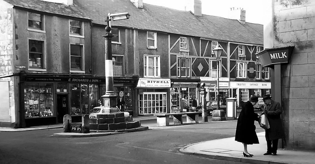
E Richards & Son stood on this site for decades. Initially it traded as E. Richards Farm Stores. Later as E. Richard & Son, ironmongers. 
This photograph was probably taken in the 1940s. Black and white markings around Market Cross and on the kerbstones only appear in a few images. Used to mark trip hazards during the blackouts in WWII. 
Market Cross and the Bull Hotel to the left 
Market Place as it was in the 1932 OS map. The bank facing South in front of St. Chads Church was demolished later in the 1930s, giving us the clear view of St. Chad’s Church that we now have. 
Buses from the days when each bus was crewed by a driver and a conductor. The style of bus would suggest the 1930s. 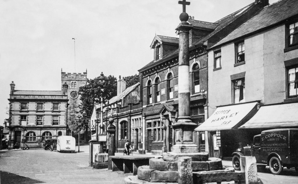
The building in front of St. Chad’s Church is shown on the 1932 Ordnance Survey Map as being a bank branch, probably what became Midland Bank. It was demolished in the late 1930s. 
1902 Gala Day procession in Market Place, also celebrating the imminent, but postponed, coronation of Edward VII. 
This gathering in Market Place probably took place in the 1920s or 1930s as the large bank building still exist at the North end. 
E. Richards store with cycle shop above it, adjoining the shop of R.W Lord, who provided many photographs & postcards of the town between 1901 and 1911. 
The building at the North end of the street and near the church is called Cyclist’s Rest, probably refreshment rooms. The hands of the church clock signify 12:25 PM. Behind the street lamp is the Police Station, without its second storey. The horse-drawn coach, advertising the Cleveleys Hydro, is outside the Blackpool Co-operative Society, on the ground floor of the Masonic Lodge. To the right is Mary Lawrenson’s bookshop and newsagents. The posters in her window report Mafeking and Ladysmith, two key events in the 2nd Boer War. Both were relieved in 1900, close to the end of the reign of Queen Victoria. The photo was probably taken soon after the arrival of photographer R W Lord, who extensively documented the town in pictures. 
An extract from the 1892 25″ Ordnance Survey map.There was then a large house at the North end of Market Place in front of St. Chad’s Church. 
Early photograph with Market Place as a cobbled street. Properties are both houses & small shops. 
Some rather grand looking buildings on the East side of Market Place 
Market Cross looking towards the Post Office when at the junction of Blackpool Old Road and Queens Square. 
An image of Market Place listed as C1864
